What is GPS?
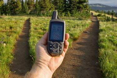
GPS stands for the Global Positioning System, which is a network of 24 satellites (plus a few extras, in case one fails) that orbit the Earth. Each satellite circles the planet twice a day at an altitude of more than 12,000 miles, all the while sending out radio signals that communicate its position and the date and time.
On Earth, a network of control and monitoring stations tracks these signals and each satellite’s status and location. But all GPS receivers—including handheld GPS devices and GPS units in cars—get these signals too, and they use them to figure out where they are.
Receivers are programmed to know how long it takes for a satellite’s signal to reach Earth. So the difference between when the signal is sent and when it is received tells the receiver how far away that satellite is. When the receiver gets the same information from at least four different satellites, it can narrow down its possible location to within 5 meters or less (depending on the receiver’s quality). That means the receiver can tell its user where he or she is, and it can start to make accurate maps of the area around it.
Location information gets put into coordinates—a set of two numbers, either in units of latitude (a number that tells you how far north or south of the equator a location is) and longitude (a number that tells how far east or west of the prime meridian a location is), or in units of the Universal Tansverse Mercator (UTM) system, which divides the earth’s surface into a series of curved, vertical or horizontal zones.
GPS was originally developed for military use, but has been available for civilian use since the 1980s. To protect national security, the U.S. military limited the accuracy of GPS information that civilians could access—by introducing random errors through a process called Selective Availability (SA)—until 2000, when President Bill Clinton signed an order ending the use of SA.
With the end of SA, civilian GPS became much more accurate, and more people became interested in using it. It isn’t just travelers who have benefited since then—everyone from scientists and surveyors to hunters and fishermen have reaped the rewards of this once top-secret system. And landowners, in particular, stand to gain a lot from learning the lay of the land through GPS.
How can I get more tips?
It’s simple! Enter your email below.